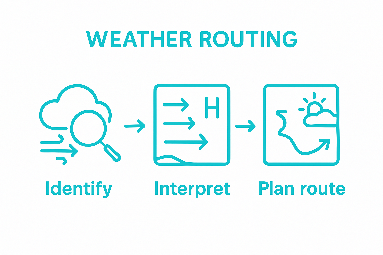
How to Read Weather Forecasts for Sailing Success
Learn how to read weather forecasts step-by-step for safer and better sailing. Gain confidence in your navigation skills today.
Sailing adventures depend on much more than just skill at the helm. Experienced captains know that using at least two to three different professional weather sources for every voyage is standard practice, not just a cautious extra. Yet, most newcomers still rely on a single weather app and miss the hidden microclimates and sudden changes that can transform a smooth trip into a frantic scramble. Seasoned sailors treat weather forecasting as both a science and an art, and understanding these insider methods could be your key to the safest and most exhilarating journey on the water.
Table of Contents
- Step 1: Identify Reliable Weather Sources
- Step 2: Interpret Weather Symbols and Terminology
- Step 3: Analyze Key Weather Factors Affecting Sailing
- Step 4: Assess Local Microclimates and Trends
- Step 5: Plan Your Sailing Route Based on Forecasts
Quick Summary
| Key Point | Explanation |
|---|---|
| 1. Use multiple weather sources | Rely on at least two to three authoritative platforms for accurate marine forecasts and data cross-referencing. |
| 2. Learn weather symbols and maps | Mastering the interpretation of marine weather symbols will enhance your ability to understand forecasts effectively. |
| 3. Monitor key weather factors | Evaluate wind patterns, pressure variations, and sea conditions consistently to inform sailing decisions. |
| 4. Assess local microclimates | Understanding specific regional weather influences helps in anticipating localized changes and challenges during sailing. |
| 5. Plan flexible sailing routes | Develop multiple contingency routes that can be quickly adapted based on real-time weather updates and conditions. |
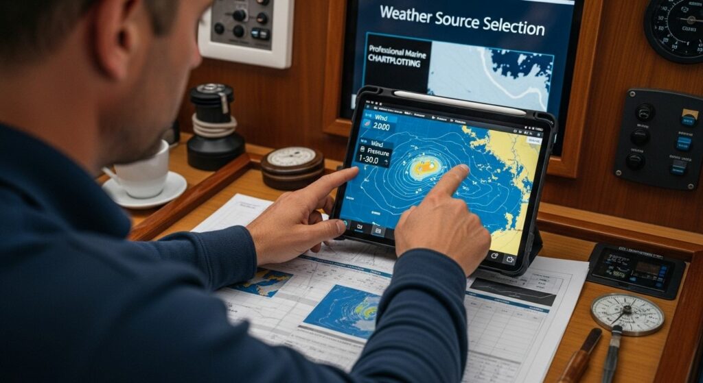
Step 1: Identify Reliable Weather Sources
Successful sailing hinges on understanding weather patterns before and during your maritime journey. Experienced skippers know that identifying reliable weather sources is the foundational step in preparing for a safe and enjoyable voyage. This critical process involves selecting multiple authoritative meteorological platforms that provide comprehensive, accurate marine forecasting.
Professional Marine Weather Resources
Professional sailors recommend establishing a multi-source approach to weather tracking. Professional marine weather services like NOAA Marine Weather offer incredibly detailed maritime forecasts that go beyond standard land-based predictions. These specialized services provide crucial information specific to nautical environments, including wave heights, wind directions, sea temperatures, and potential storm developments.
Your weather source selection should prioritize platforms that offer real-time data and historical tracking capabilities. Summer Yacht Charters experienced skippers suggest maintaining subscriptions or regular access to multiple resources to cross-reference predictions. Key marine weather platforms to consider include:
- Global Maritime Weather Services: Professional subscription-based platforms
- National Meteorological Agency Websites: Government-backed marine forecasts
- Specialized Sailing Weather Applications: Mobile and desktop tools designed for maritime professionals
When evaluating weather sources, look for platforms that provide granular details such as wind speed, wave height, precipitation probability, atmospheric pressure, and potential marine warnings. Experienced charterers understand that local knowledge combined with professional forecasting creates the most reliable prediction model.
Below is a comparison of common professional marine weather sources referenced by sailors, highlighting their features and usage in sailing preparation.
| Weather Source Type | Example | Key Features | Usage in Sailing Preparation |
|---|---|---|---|
| Global Maritime Weather Services | Professional subscription-based platforms | Detailed forecasts, real-time updates, historical data | Cross-reference and in-depth route planning |
| National Meteorological Agency Websites | National government marine forecasts | Authoritative data, official marine warnings | Primary forecasting, compliance with regulations |
| Specialised Sailing Weather Applications | Mobile/desktop tools for mariners | Customisable alerts, route-specific forecasts | On-the-go monitoring and decision-making |
| Local Maritime Reports | Local authorities, harbourmasters | Microclimate insights, real-time local updates | Fine-tuning plans based on local conditions |
| Historical Weather Data Archives | Agency websites, sailing clubs | Long-term trend analysis | Understanding regional weather patterns |
Remember that no single weather source is infallible. Experienced skippers always recommend cross-referencing at least two to three different professional maritime weather services before making navigation decisions. This approach helps mitigate potential risks and provides a more comprehensive understanding of anticipated maritime conditions.
Successful weather forecast reading requires patience, practice, and a systematic approach to gathering and interpreting maritime meteorological data. By establishing a robust, multi-source weather tracking strategy, you’ll significantly enhance your sailing preparedness and safety.
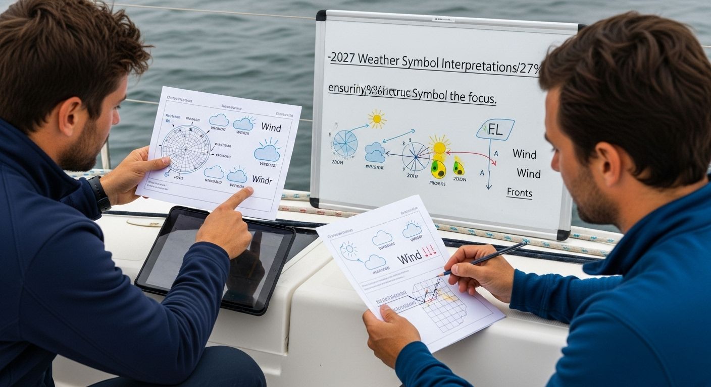
Step 2: Interpret Weather Symbols and Terminology
Decoding weather forecasts is an essential skill for any sailor, transforming complex meteorological information into actionable navigation strategies. Weather symbols and terminology represent a specialized language that can initially seem overwhelming but becomes intuitive with systematic learning and practice.
Deciphering Marine Weather Maps
Marine weather maps are intricate visual representations packed with critical information for sailors. Understanding these symbols requires a methodical approach that goes beyond casual observation.
Wind barbs, pressure systems, and frontal boundaries all communicate vital details about potential sailing conditions. Wind direction and speed indicators are particularly crucial, with each symbol providing precise information about anticipated maritime weather patterns.
Traditional weather maps utilize standardized symbols that represent specific atmospheric conditions. A triangular symbol might indicate a cold front, while a semicircle could represent a warm front. Pressure system indicators reveal low and high-pressure zones, which directly impact wind patterns and potential storm developments. Summer Yacht Charters experienced skippers emphasize the importance of understanding these visual cues before setting sail.
Learning to interpret these symbols effectively involves studying standard marine meteorological conventions. Professional sailors recommend creating a personal reference guide that includes:
- Wind barb interpretations: Understanding length, direction, and flag indicators
- Pressure system symbols: Recognizing low and high-pressure zone representations
- Frontal boundary markers: Identifying potential weather transition zones
According to National Weather Service Marine Forecasting Guidelines, successful maritime navigation requires more than passive symbol recognition. It demands active interpretation and understanding of how these visual elements interact to create comprehensive weather predictions.
Practical skill development involves consistent practice and cross-referencing multiple weather sources. Experienced charterers suggest spending time comparing different weather maps, noting how symbols translate into actual maritime conditions. This approach transforms abstract symbols into practical sailing intelligence, enabling more confident and safer navigation decisions.
Remember that weather symbol interpretation is a dynamic skill. Meteorological conventions occasionally update, and technological advancements continue to refine how weather information is presented. Staying current with these changes through continuous learning and professional maritime weather resources will enhance your sailing preparedness and decision-making capabilities.
Step 3: Analyze Key Weather Factors Affecting Sailing
Successful maritime navigation demands a comprehensive understanding of the complex weather factors that directly impact sailing conditions. Analyzing weather dynamics transforms raw meteorological data into actionable sailing strategies, enabling skippers to make informed decisions that ensure crew safety and voyage success.
Wind patterns represent the most critical factor in maritime navigation. Wind speed, direction, and consistency fundamentally determine sailing feasibility and vessel performance. Professional sailors examine wind forecasts meticulously, understanding that sustained wind conditions differ dramatically from momentary gusts. Tracking wind trajectories helps predict potential challenges, allowing sailors to anticipate and adapt to changing maritime environments.
Barometric pressure serves as another crucial indicator of potential weather transformations. Rapid pressure shifts signal imminent meteorological changes that could significantly impact sailing conditions. Pressure system movements reveal approaching frontal boundaries, potential storm developments, and wind pattern disruptions. Summer Yacht Charters experienced skippers recommend monitoring pressure trends over several hours to understand developing weather scenarios.
Key weather factors sailors must consistently evaluate include:
- Wind speed and directional consistency
- Barometric pressure variations
- Sea surface temperature
- Precipitation probability
- Visibility conditions
According to National Oceanic and Atmospheric Administration Marine Forecasting, understanding these interconnected weather elements requires a holistic approach. Sailors must recognize how individual factors influence overall maritime conditions. Temperature differentials, humidity levels, and atmospheric stability all contribute to creating complex weather scenarios that demand careful interpretation.
This table summarises the most critical weather factors to evaluate before and during any sailing voyage, along with their significance to sailing outcomes.
| Weather Factor | Why It Matters for Sailing | What to Monitor |
|---|---|---|
| Wind speed and direction | Determines sail trim, vessel speed, and safety | Forecasted speed, consistency, gusts |
| Barometric pressure | Signals approaching weather systems or changes | Rising/falling trends, rapid shifts |
| Sea surface temperature | Affects local weather patterns and comfort | Temperature shifts, unusual readings |
| Precipitation probability | Influences visibility and onboard safety | Rain, thunderstorms, mist |
| Visibility conditions | Impacts navigation and collision risk | Fog, haze, heavy rain |
Most experienced sailors develop a systematic approach to weather analysis. This involves cross-referencing multiple professional weather sources, understanding local maritime microclimates, and maintaining a flexible sailing strategy. Learn more about Mediterranean sailing weather patterns to enhance your predictive capabilities.
Practical weather analysis extends beyond theoretical understanding. Successful sailors cultivate an intuitive sense of maritime meteorological dynamics through consistent practice, observation, and willingness to adjust plans based on emerging conditions. Remember that weather forecasting remains an imprecise science, and maintaining situational awareness is paramount to safe and enjoyable sailing experiences.
Step 4: Assess Local Microclimates and Trends
Navigating maritime environments requires more than generic weather forecasts. Microclimate assessment represents a sophisticated approach to understanding localized weather conditions that can dramatically impact sailing performance and safety. Summer Yacht Charters experienced skippers recognize that topographical features, coastal landscapes, and regional atmospheric dynamics create unique weather patterns distinct from broader meteorological predictions.
Coastal and island landscapes generate complex wind and temperature interactions that standard weather maps often overlook. Terrain-influenced microclimates can produce sudden wind shifts, unexpected thermal variations, and localized precipitation patterns. Mountain ranges, peninsula configurations, and archipelago structures create wind tunnels and turbulence zones that require specialized navigation strategies. Professional sailors learn to read these intricate environmental nuances as carefully as they read maritime charts.
Successful microclimate assessment involves developing a multifaceted observational approach. This means combining technological tools with local knowledge and personal experience. Experienced sailors collect data through multiple channels, including professional weather services, local maritime reports, and real-time environmental observations. Advanced sailors maintain detailed logs documenting regional weather trends, creating personalized reference materials that capture the subtle variations of specific sailing locations.
Key strategies for effective microclimate evaluation include:
- Consulting local maritime authorities
- Studying historical weather data for specific regions
- Engaging with experienced local sailors
- Utilizing advanced meteorological mapping technologies
- Documenting personal observations during multiple voyages
According to National Oceanic and Atmospheric Administration Marine Forecasting, understanding microclimate dynamics requires continuous learning and adaptability. Each maritime region presents unique challenges, and sailors must remain flexible in their approach to weather interpretation.
Explore Mediterranean sailing strategies to gain deeper insights into regional microclimate complexities. Professional sailors understand that microclimate assessment is not a one-time activity but an ongoing process of observation, documentation, and adaptation.
Ultimately, mastering microclimate assessment transforms sailors from passive weather observers to proactive navigators. By developing a nuanced understanding of local environmental dynamics, you can anticipate potential challenges, optimize sailing routes, and enhance overall maritime safety. The most successful sailors view weather not as an external force, but as a dynamic system they can understand and work alongside.
Step 5: Plan Your Sailing Route Based on Forecasts
Transforming weather forecasts into a strategic sailing route requires precision, flexibility, and a comprehensive understanding of maritime conditions. Route planning is not merely about selecting a destination but crafting a dynamic navigation strategy that prioritizes crew safety and vessel performance across changing environmental scenarios.
Professional sailors approach route planning as a sophisticated decision-making process that integrates multiple meteorological and geographical considerations. Weather forecast analysis becomes the cornerstone of effective route selection, requiring sailors to evaluate wind patterns, potential storm systems, sea conditions, and localized microclimate influences. Summer Yacht Charters experienced skippers emphasize the importance of developing multiple contingency routes that can be quickly adapted based on evolving weather dynamics.
Successful route planning involves creating a flexible navigation framework that allows for real-time adjustments. This means developing primary and secondary routes, identifying potential safe harbours, and maintaining constant communication with maritime weather services. Detailed route documentation should include comprehensive waypoints, estimated travel times, fuel requirements, and potential alternative navigation strategies that account for projected weather shifts.
Critical elements sailors must consider during route planning include:
- Projected wind speed and direction
- Wave height and sea state predictions
- Potential storm system trajectories
- Coastal navigation challenges
- Emergency shelter locations
According to National Oceanic and Atmospheric Administration Marine Forecasting, effective route planning requires a holistic approach that balances technological insights with maritime expertise. Professional navigators understand that weather forecasts provide guidance, not guarantees, and must remain prepared to modify their strategies instantaneously.
Discover expert sailing route strategies to enhance your navigation skills and preparedness. The most successful sailors view route planning as a continuous, dynamic process that demands ongoing attention, adaptability, and a profound respect for maritime environmental complexities.
Ultimately, route planning transcends technical skill and becomes an art form that combines meteorological knowledge, navigational expertise, and intuitive decision-making. By developing a systematic approach to interpreting weather forecasts and translating them into actionable sailing strategies, you transform potential challenges into opportunities for safe, efficient, and enjoyable maritime adventures.
Transform Your Weather Knowledge into Unforgettable Mediterranean Sailing
You have just mastered the essentials of interpreting weather forecasts for sailing success. But even the most diligent sailors can face uncertainty out at sea, whether deciphering microclimates or planning safe, efficient routes. At Summer Yacht Charters, we understand how overwhelming it can feel to translate complex weather data into real-life decision-making, especially when the stakes involve your holiday and safety.
Ready to put your newfound weather reading skills into action? Browse over 11,000 carefully selected yachts across Greece, Croatia, Italy and beyond, all on a platform designed to make route planning effortless and transparent. Whether you prefer the autonomy of a bareboat charter or want a crew expertly attuned to the latest forecasts, our team will help you turn every prediction into a personalised adventure. Start today by visiting Summer Yacht Charters or dive deeper into expert sailing route strategies. Make your next voyage not only safe, but truly exceptional. Now is the perfect time to plan with confidence.
Frequently Asked Questions
What are the best reliable weather sources for sailing?
To ensure safe sailing, it’s essential to select multiple reliable weather sources, such as NOAA Marine Weather, national meteorological agency websites, and specialized sailing weather applications. These platforms provide detailed marine forecasts specific to sailing conditions.
How do I interpret marine weather maps and symbols?
Marine weather maps use standard symbols to convey complex information. Familiarising yourself with these symbols, such as wind barbs and pressure system indicators, is crucial. Creating a reference guide can help you interpret these maps effectively.
What key weather factors should I analyse for sailing?
Key weather factors to consider for sailing include wind speed and direction, barometric pressure, sea surface temperature, precipitation probability, and visibility conditions. Analyzing these factors helps predict sailing conditions and navigate safely.
How can I assess local microclimates that affect sailing?
Assessing local microclimates involves observing the specific geographical features of the area, consulting local maritime authorities, studying historical weather data, and engaging with experienced local sailors. This multifaceted approach enhances your understanding of localized weather patterns that may impact sailing.